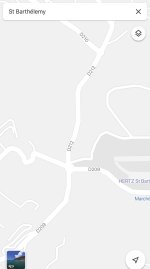
Rosemond may be able to provide better information than I can, but this is what I know. There are actually road signs, maybe 2.5”by 5” which have the official Departmental (The “D” I think) route numbers on them. I’m familiar with three, the D209, the D210, and the D211. I’ve only seen them published on topographical maps of the island, and is sometimes unclear exactly where they start and end. The D210 has one end in Flamands, but it’s not clear where it ends - maybe La Tourmente? The D209 runs from Gustavia, through St Jean, past your villa, and somewhere after that it turns into the D211, which continues from Grand Fond, past the Normandie, to where it ends at the intersection by the Mini-mart and the Cemetery.
Many (all?) of the smaller roads outside of Gustavia have numbers too, but I have never seen a map which shows them. I see them on notices of road closures for construction, but nowhere else.