Intriguing weather in 2018

Status
Not open for further replies.
A perfect example/proof of the new trend

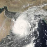
Cyclone Mekunu was nearing landfall on the coast of southern Oman near or just west of the city of Salalah (metro population 320,000). Mekunu’s top 1-minute sustained winds had increased to 100 knots (115 mph) at 12Z, making it the equivalent of a Category 3 hurricane. If Mekunu comes ashore at that strength, or even at Category 2 strength, it will be the most powerful cyclone at landfall for this part of the Arabian Peninsula in at least the past 60 years.

Satellite loops show that Mekunu carried out an impressive burst of intensification as it neared the Oman coastline

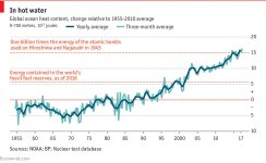
As it seems some people don't fully understand the link between ocean warnings and rapid intensification,this is what it is about ..Check data about "hurricane Maria" to get an idea.

The same phenomena at play with Irma is also true with Mekunu :Waves estimated by JTWC as high as 32 feet will be slamming into the coast atop a significant storm surge

This is why the collectivity is going to build a 13 millions euros shelter on high grounds.
 
00.jpg

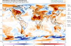
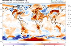
A quick update on this map too...The heatwave is back again over north Africa
One can wonder how it might impact systems coming out of Africa this summer.
 
Has Oman ever suffered from a weather event as bad as Mekunu?

Tropical cyclones often weaken as they approach Oman and ingest dry desert air from the Arabian Peninsula. However, Oman is not invulnerable to cyclone disasters, two of which have occurred in the last 11 years.
Cyclone Phet, June 2010: Phet came ashore in far eastern Oman as a strong Category 2 storm, with top winds of 110 mph, according to the Joint Typhoon Warning Center (JTWC). At least 24 deaths were reported in Oman, with 23 other fatalities occurring in India and Pakistan as Phet moved by in a much-weakened state
Cyclone Gonu, June 2007: Gonu peaked as a Category 5 equivalent before passing just offshore of the eastern tip of Oman as a Category 1 storm and going on to become the first tropical cyclone on record to make landfall in Iran. Gonu was the strongest cyclone ever recorded in the Arabian Sea; in Oman, it caused at least 50 deaths
Prior to Gonu, the last significant tropical cyclone to affect Oman was in 1890, when a storm hit the Gulf of Oman coast and Muscat, dumping 270 mm of rain (10.63”) killing 700 people.

Now ,some data about GONU
Gone developed on June 1, 2007.With a favorable upper-level environment and warm sea surface temperatures, it rapidly intensified to attain peak winds of 235 km/h (145 mph) on June 4
There are signs that pre-monsoon (springtime) Arabian Sea cyclones have gotten stronger in the last 20 years.

Surely a coincidence )

TC_Gonu_05_June_07_0635Z.jpg
 
A new forecast for the hurricane season


https://www.ft.com/content/7f9d3eaa-619a-11e8-90c2-9563a0613e56

Munich Re, the world’s second largest reinsurer, is expecting significantly fewer intense tropical storms than last year as the hurricane season approaches. “Our models suggest that the 2018 hurricane season is likely to be an average one,” Munich Re executive board member Torsten Jeworrek told the Financial Times. The reinsurer said that about three large hurricanes appear likely this year, compared with twice as many in 2017. The season spans June 1 to November 30.
 
splitEW.jpganoma.5.28.2018.jpganomw.5.28.2018.jpg00.jpg

An update on the situation affecting the north atlantic
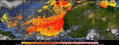
As usual for the season,the SAL is extremely strong.I also presume it's stronger than usual because of the permanent heatwave over north Africa.
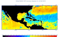
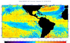
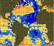
The atlantic ocean is still really fresh for the season,specially between the 10th and 20th parallel (the crucial one for ST Barth)
Looking good and safe for the moment
 
Looks like the worst of Alberto is behind us! Lots of flooding and a TV anchor was killed by a falling tree.

https://www.usatoday.com/story/news...or-photographer-killed-fatal-wreck/650175002/

According to reports i saw,it seems 2 people died (a news anchor and a photojournalist).
In Hawaii,the volcano keeps erupting amid several earthquakes, and the lava reached a highway,a geothermal plant and destroyed 82 homes.It also seems the holiday bookings for summer are down over 50%.
Some incredible footage online (https://youtu.be/_zEDz0jZ9Yc) ,not to mention this crazy photo

LAVA_POOL_1_1280x720_27378757531.jpg
 
Some very important data just came out,concerning the Paris agreement about climate change.
Promises were great.I wrote about it in previous posts,mentioning what it would take to make it happen.(14 millions windmills,650.000 km2 of solar panels and so on).
Data is out for 2017.Growth reached 3.7% in G20 countries,electricity consumption up 2,1%...and CO2 emissions up...2%
And the trend has been pretty similar in 2015 and 2016.To reach the 2050 objectives,emissions now need to go down 3.5% every year till 2050.

Is Saint Barth concerned ? you bet.Check the graph belowIMG_0072.jpg
 
[COLOR=rgba(0, 0, 0, 0.729412)][FONT=&quot] Some logical news,in the new forecast

In a revised seasonal forecast released Thursday, top scientists from Colorado State University said a near-average season is likely, with 14 named storms, of which six would become hurricanes.[/FONT][/COLOR]
[COLOR=rgba(0, 0, 0, 0.729412)][FONT=&quot]A tropical storm becomes a hurricane when its wind speed reaches 74 mph.[/FONT][/COLOR]
[COLOR=rgba(0, 0, 0, 0.729412)][FONT=&quot]This is a decrease from a forecast the group released in April. The reason for the revised predictions is that seawater in the eastern Atlantic Ocean is unusually cold for this time of year, meteorologist Phil Klotzbach said. The cool water means less fuel for hurricanes to form.[/FONT][/COLOR]
[COLOR=rgba(0, 0, 0, 0.729412)][FONT=&quot]In addition, a weak El Niño could also form later in the year, which tends to suppress Atlantic hurricane development.[/FONT][/COLOR]
 
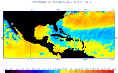
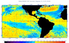
anoma.5.31.2018.jpganomw.5.31.2018.jpg

The usual update about the SST in the atlantic...no change here
And Colorado state university confirmed it was the coldest since 1994
[FONT=&quot]the SST anomaly pattern now is less conducive for an active Atlantic hurricane season than was present in late March," the CSU outlook said.[/FONT]
[FONT=&quot]The cooler-than-average waters in the tropical Atlantic are being driven by northerly winds around the eastern periphery of a strong area of high pressure over the eastern and central Atlantic Ocean. On the western periphery of this high, southerly winds have led to above-average water temperatures off the U.S. East Coast.

This means any storm that would manage to form in the caribbean will find plenty of heat content when arriving near the US,leading to rapid or explosive intensification.
Dear american friends,it's never too early to get ready[/FONT]
 
Get ready for an above-average hurricane season in 2018

https://www.cnn.com/2018/05/24/us/national-hurricane-center-season-forecast-wxc/index.html

CNN)The 2018 hurricane season is shaping up to be "near- or above-normal" -- though not to the degree seen last year, when 17 named storms formed and three major hurricanes struck US soil -- the National Oceanic and Atmospheric Administration, or NOAA, said Thursday.

Ten to 16 named storms -- including five to nine hurricanes, and one to four major hurricaneswith Category 3 strength or higher -- are predicted this Atlantic hurricane season, which begins June 1, the federal agency predicted.... cont'd
 
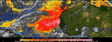
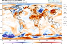
The usual update ...Always this heatwave over north Africa,triggering massive amounts of dry air over the atlantic (which is normal for the season).Much more relevant for St Barth is the last map,showing the atlantic cooling even more around the african coast and between the 10th and 20th parallel.
For our american friends living on the east coast,water is much warmer than usual.Hopefully no hurricane will visit the area this summer.Otherwise,heat content will prove a major risk for the landing.Same goes for the GOM.

splitEW.jpg00-1.jpgsst_anom.jpg
 
MIT professor weighs in on hurricanes

"There are several areas where there's a strong scientific consensus. One is that a given hurricane is going to produce a lot more rain as the climate warms, and we're beginning to see signs of that happening. That's for a very simple reason — that a warmer atmosphere has more water vapor in it. There's really no controversy about that. We expect to see more [Hurricane] Harvey-type events as we go forward.
Another indisputable thing is that the sea level is going up, and it's almost certainly going to continue to go up. The largest killer in hurricanes is something called the storm surge, which was what flooded New Orleans during [Hurricane] Katrina and New York during [Superstorm] Sandy. Even if the storms themselves don’t change, the surges are riding on an elevated sea level, and that makes them more dangerous.
There's also a reasonably strong consensus that we're going to see more intense hurricanes. That's because the theory that ties the sort of maximum speed limit that you can have on hurricanes is very clear. As you warm up the system, the speed limit goes up. We're going to see more intense hurricanes, and we are seeing signs of that in the data.
Sudden intensification of hurricanes before a landfall is a scary scenario, and I wrote a paper last year that global warming actually makes that somewhat more likely than it has been in the past."

You can read more here
http://news.mit.edu/2017/kerry-emanuel-hurricanes-are-taste-future-0921

 
A new downgrade for the hurricane season

[FONT=&quot] IBM's Weather Company currently predicts a total of 12 named storms, five hurricanes, and two major hurricanes. In 2017, there were 17 named storms, 10 hurricanes and 6 major hurricanes in the Atlantic basin.[/FONT]
[FONT=&quot][/FONT]
[FONT=&quot]In fact, the 2018 cycle's predictions are below what the IBM's Weather Company forecast last month, and below the annual average of 12 storms, 7 hurricanes and 3 major hurricanes, compiled since 1950.

The weather expert said some of the cities at risk include some of the usual suspects like Miami, New Orleans and Norfolk, Virginia. Further north, however, New York City and Boston could also be at risk.[/FONT]
 
More consequences of the 2017 hurricane season and how it impacts everyone....and how companies are reacting

Motiva Enterprises says it will not add processing capacity at its 603K bbl/day refinery in Port Arthur, Tex., a significant change in the refiner's plans from just two months ago when the company said it was considering adding as much as 900K bbl/day of processing capacity.
The decision puts Saudi-backed Motiva on a path to buy or build another refining plant in the U.S., and Reuters reports the decision stems from the Port Arthur refinery's shutdown after Hurricane Harvey flooded the area, as the company never again wants all of its capacity shut.
Other Gulf Coast refiners, including Exxon Mobil and Total , are bolstering their storm defenses as well as adding generators and pumps at their area facilities; XOM is considering expanding its Beaumont, Tex., refinery and two others along the Gulf Coast to double its ability to process growing U.S. shale oil but has not reached a final decision.
 
Status
Not open for further replies.
Top