
You are using an out of date browser. It may not display this or other websites correctly.
You should upgrade or use an alternative browser.
You should upgrade or use an alternative browser.
Something to watch
- Thread starter BBT
- Start date

BBT
Senior Insider
Stay where it's cool.I have to gogo back home first :thinking1:

BBT
Senior Insider
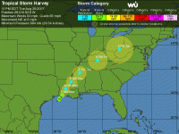
BRIDGETOWN, Barbados, Thursday August 17, 2017 – A tropical depression that forecasters say is likely to become Tropical Storm Harvey later today is headed for the Windward Islands.
A tropical storm warning is now in effect for Barbados, St Lucia, Martinique and St Vincent and the Grenadines while a tropical storm watch has been issued for Dominica.
At 11 a.m., when the National Hurricane Centre (NHC) in Miami issued its first bulletin on potential tropical cyclone number nine, the depression was 365 miles east of Barbados and 465 miles east of St Lucia and carrying maximum sustained winds near 35 miles per hour.
The system is moving toward the west near 17 miles per hour and that motion is expected to continue for the next couple of days. On the forecast track, the disturbance should move through the Windward Islands and into the eastern Caribbean Sea tomorrow.

“The disturbance is expected to become a tropical cyclone later today or tonight, and it could become a tropical storm before reaching the Windward Islands. If the current trends continue, the system will likely become a tropical cyclone later today or tonight. An Air Force Reserve Hurricane Hunter aircraft is scheduled to investigate the disturbance this afternoon,” the NHC said.
Tropical storm conditions are expected to first reach the Lesser Antilles within the warning area by early tomorrow, while tropical storm conditions are possible in the watch area tomorrow.
The system is expected to produce rainfall totals of 2 to 4 inches across portions of the Windward Islands from Martinique southward to Grenada.
“These rains could cause life-threatening flash floods and mudslides,” the NHC warned.
Read more: http://www.caribbean360.com/news/po...harvey-heading-windward-islands#ixzz4q2H78z7f
A tropical storm warning is now in effect for Barbados, St Lucia, Martinique and St Vincent and the Grenadines while a tropical storm watch has been issued for Dominica.
At 11 a.m., when the National Hurricane Centre (NHC) in Miami issued its first bulletin on potential tropical cyclone number nine, the depression was 365 miles east of Barbados and 465 miles east of St Lucia and carrying maximum sustained winds near 35 miles per hour.
The system is moving toward the west near 17 miles per hour and that motion is expected to continue for the next couple of days. On the forecast track, the disturbance should move through the Windward Islands and into the eastern Caribbean Sea tomorrow.
“The disturbance is expected to become a tropical cyclone later today or tonight, and it could become a tropical storm before reaching the Windward Islands. If the current trends continue, the system will likely become a tropical cyclone later today or tonight. An Air Force Reserve Hurricane Hunter aircraft is scheduled to investigate the disturbance this afternoon,” the NHC said.
Tropical storm conditions are expected to first reach the Lesser Antilles within the warning area by early tomorrow, while tropical storm conditions are possible in the watch area tomorrow.
The system is expected to produce rainfall totals of 2 to 4 inches across portions of the Windward Islands from Martinique southward to Grenada.
“These rains could cause life-threatening flash floods and mudslides,” the NHC warned.
Read more: http://www.caribbean360.com/news/po...harvey-heading-windward-islands#ixzz4q2H78z7f

tim
Moderator
BRIDGETOWN, Barbados, Thursday August 17, 2017 – A tropical depression that forecasters say is likely to become Tropical Storm Harvey later today is headed for the Windward Islands.
A tropical storm warning is now in effect for Barbados, St Lucia, Martinique and St Vincent and the Grenadines while a tropical storm watch has been issued for Dominica.
At 11 a.m., when the National Hurricane Centre (NHC) in Miami issued its first bulletin on potential tropical cyclone number nine, the depression was 365 miles east of Barbados and 465 miles east of St Lucia and carrying maximum sustained winds near 35 miles per hour.
The system is moving toward the west near 17 miles per hour and that motion is expected to continue for the next couple of days. On the forecast track, the disturbance should move through the Windward Islands and into the eastern Caribbean Sea tomorrow.
“The disturbance is expected to become a tropical cyclone later today or tonight, and it could become a tropical storm before reaching the Windward Islands. If the current trends continue, the system will likely become a tropical cyclone later today or tonight. An Air Force Reserve Hurricane Hunter aircraft is scheduled to investigate the disturbance this afternoon,” the NHC said.
Tropical storm conditions are expected to first reach the Lesser Antilles within the warning area by early tomorrow, while tropical storm conditions are possible in the watch area tomorrow.
The system is expected to produce rainfall totals of 2 to 4 inches across portions of the Windward Islands from Martinique southward to Grenada.
“These rains could cause life-threatening flash floods and mudslides,” the NHC warned.
Read more: http://www.caribbean360.com/news/po...harvey-heading-windward-islands#ixzz4q2H78z7f
I like the animated post!
BBT
Senior Insider
It was a cut and paste and I was surprised it kept the anamation alsoI like the animated post!
BBT
Senior Insider
By 2 p.m., Harvey was moving into the Caribbean Sea and away from the Windward Islands. All tropical storm warnings and watches were discontinued.
At that time, the storm was about 60 miles west of St Vincent and 85 miles west southwest of St Lucia, and headed towards the west at 21 miles per hour.

Harvey, carrying maximum sustained winds near 40 miles per hour, is expected to continue on its current track for the next couple of days, moving away from the Windward Islands and through the eastern Caribbean Sea this afternoon and tonight before moving into the central Caribbean Sea tomorrow, the National Hurricane Centre (NHC) in Miami said.
Weather conditions in the Windward Islands are expected to improve as the day progresses.
However, Tropical Storm Harvey is expected to produce additional rainfall totals of 1 to 2 inches with locally higher amounts across parts of the Leeward and Windward Islands, from Guadeloupe southward to Grenada, which could cause life-threatening flash floods and mudslides.
Read more: http://www.caribbean360.com/news/tr...-caribbean-sea-causing-flooding#ixzz4q8TYgWxZ
At that time, the storm was about 60 miles west of St Vincent and 85 miles west southwest of St Lucia, and headed towards the west at 21 miles per hour.
Harvey, carrying maximum sustained winds near 40 miles per hour, is expected to continue on its current track for the next couple of days, moving away from the Windward Islands and through the eastern Caribbean Sea this afternoon and tonight before moving into the central Caribbean Sea tomorrow, the National Hurricane Centre (NHC) in Miami said.
Weather conditions in the Windward Islands are expected to improve as the day progresses.
However, Tropical Storm Harvey is expected to produce additional rainfall totals of 1 to 2 inches with locally higher amounts across parts of the Leeward and Windward Islands, from Guadeloupe southward to Grenada, which could cause life-threatening flash floods and mudslides.
Read more: http://www.caribbean360.com/news/tr...-caribbean-sea-causing-flooding#ixzz4q8TYgWxZ

BBT
Senior Insider
FLORIDA, United States, Wednesday August 30, 2017 – Tropical Storm Irma has made an appearance and residents of the Caribbean are being advised to track its progress because it could potentially threaten some islands next week.
Earlier this week, the National Hurricane Centre (NHC) in Miami said potential tropical cyclone number 10 which was located off the southeast US coast had the potential to become the next named storm of the Atlantic hurricane season. But it was a tropical wave off the Cabo Verde Islands at that time that has developed into Irma.
The NHC said in its 11 a.m. advisory that Irma had formed over the far eastern Atlantic, but it posed no immediate threat. It was about 420 miles west of the Cabo Verde Islands and moving toward the west near 13 miles per hour at the time.

According to the NHC, that general motion is expected to continue for the next couple of days, along with some strengthening, and Irma, currently carrying maximum sustained winds near 50 miles per hour, could become a hurricane by Friday.
Read more: http://www.caribbean360.com/news/tr...ic-interests-caribbean-keep-eye#ixzz4rGu2Pk2l
Earlier this week, the National Hurricane Centre (NHC) in Miami said potential tropical cyclone number 10 which was located off the southeast US coast had the potential to become the next named storm of the Atlantic hurricane season. But it was a tropical wave off the Cabo Verde Islands at that time that has developed into Irma.
The NHC said in its 11 a.m. advisory that Irma had formed over the far eastern Atlantic, but it posed no immediate threat. It was about 420 miles west of the Cabo Verde Islands and moving toward the west near 13 miles per hour at the time.
According to the NHC, that general motion is expected to continue for the next couple of days, along with some strengthening, and Irma, currently carrying maximum sustained winds near 50 miles per hour, could become a hurricane by Friday.
Read more: http://www.caribbean360.com/news/tr...ic-interests-caribbean-keep-eye#ixzz4rGu2Pk2l


fins85258
Senior Insider
this might be a good time to think about battening down the hatches
http://www.nhc.noaa.gov/refresh/graphics_at1+shtml/024654.shtml?hwind120
http://www.nhc.noaa.gov/refresh/graphics_at1+shtml/024654.shtml?hwind120


