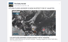
Storm coming?

cec1

Senior Insider
Dinner tonight at Eddy's . . . penultimate night. A pretty good wind storm between 10 & 11 -- refreshing, cool "breeze." Weather has been amazingly dry all week.

Very light sprinkles on the way home. While passing through Grand Fond, however, rain became harder -- small drops, but falling steadily. Arrived home to sweet sound of water running into the cistern . . . and very dry gardens already were smiling!

In all, a great evening!
 
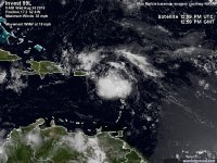
You should have a day of rain from tropical wave 99L, which hasn't quite yet grown into a Tropical Depresion. 4.1mm (.15") of rain has been reported as of 03:00 at the PWS up in Dévet, and 2.3mm in Lorient. For those with gardens and cisterns, it's a start!
 
image.jpeg
 
Intermittent heavy showers this morning . . . your report, Kevin, is on the mark.

I hope there will be a clearing at end of the day for tonight's fireworks ("feu d'artifice") in celebration of the Fete du St. Barthelemy. This morning's champagne reception at the Hotel du Collectivite is likely to go on as scheduled . . . what honorable patron of St. Barthelemy would allow some rain to interfere with a morning coupe de champagne?
 
Last edited:
Really nice out in L'Orient after several blazing hot days. Mini Mart is closed, but Oasis is open. Not much rain, nice wind. May pop over to Rositas "swimming hole" in front of Les Basses for a dip.
 
Invest 99L is already bringing winds of tropical storm force to the northern Lesser Antilles Islands, and it could become a tropical storm at any time over the next day as it heads west-northwest at 15 mph towards Puerto Rico and the Virgin Islands. At Barbuda, sustained winds at minimal tropical storm-force—39 mph—were observed at 7:18 am AST, with a wind gust of 45 mph. At 10 am AST, Princess Juliana Airport in St. Maartinrecorded sustained winds (below tropical storm-force) of 32 mph, gusting to 48 mph.

An Air Force hurricane hunter aircraft was investigating 99L late Wednesday morning, and found sustained surface winds of 45 - 50 mph, and sustained winds at their 500-foot flight level of 50 - 55 mph. At 11:35 am EDT, the National Hurricane Center issued a special Tropical Weather Outlook noting that the reconnaissance mission was still ongoing. As soon as 99L develops a well-defined surface circulation, it will be called Tropical Storm Hermine.

The storm was generating heavy rains over the northern Lesser Antilles Islands on Wednesday morning, as seen on radar out of Martinique. Satellite loops on Wednesday morning showed that heavy thunderstorm activity had increased in intensity over the previous 24 hours, and had grown more organized. A well-defined surface circulation had not yet formed, though several swirls in the cloud pattern suggested that the storm may not be far from establishing one. Moderate to high wind shear of 15 - 25 knots along the north side of the storm was keeping all of 99L’s heavy thunderstorms confined to the south. Dry air from the Saharan Air Layer (SAL) was still hindering development, as seen on water vapor satellite imagery. Sea surface temperatures (SSTs) were favorable for development: 29°C (84°F), about 0.5°C above average. A flash flood watch is posted for Puerto Rico and the U.S. Virgin Islands, where 2 - 4 inches of rain are expected.
 
Top