andynap
Senior Insider
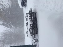
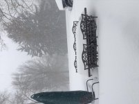
I know DC and Virginia are getting killed too. Jersey shore will be getting severe flooding.
Cecily Tynan1 hr ·
BLIZZARD WATCH POSTED!
The National Weather Service just issued a blizzard watch Friday evening through Sunday morning for most of our viewing area (far suburb...s NW suburbs not included because winds won't be as strong there, and Cape May County not included because mixing will lessen blowing snow.)
Blizzard conditions are defined as when you gets sustained or prolonged wind gusts of at least 35 mph along with blowing snow that reduces visibility to less than a quarter-mile; all for at least three hours straight.
Very few storms meet that criteria (even the "Blizzard of '96" technically didn't.)
But, no doubt, we will have blizzard conditions for a while so I think this watch was a good move! Kudos, by the way, to Chris Sowers started saying this could be known as "Blizzard of 2016" back on Monday.
image: http://media.philly.com/designimages/partnerIcon-Inquirer-2014.jpg

The Philadelphia region is already gearing up for a weekend snowstorm.
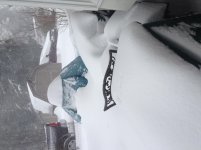
The latest National Weather Service projections say most of the area will see blizzard conditions and 12 to 18 inches of snow by the time the storm ends early Sunday, easily the largest snowfall for the region this winter.
In advance of the storm, which is expected to arrive Friday evening, roads were being prepped, travelers were making alternate plans and consumers were stocking up on groceries and other goods.
In the meantime, some snow fell overnight in different parts of region, with reported accumulations ranging from 2.8 inches in Atlantic City to about of half-inch points west of there.Weather Service
The National Weather Service has put the region under a Blizzard Watch effective Friday evening through Sunday morning. A Coastal Flood Watch also will be in effect at the Shore and along the Delaware Bay. These alerts could change as the storm gets closer.
The weather service's latest briefing calls 12 to 18 inches of snow the most likely amount for the Philadelphia area, with less along the New Jersey coast and in the Poconos.
A Blizzard Watch means there is a potential for strong winds and heavy and blowing snow. Winds of 20 to 30 mph, with frequent gusts of up to 40 mph, will reduce visibility to a quarter-mile or less at times. This "can lead to whiteout conditions and make travel very dangerous," the watch says.
The weather service also says the snow is expected to be dry and fluffy at the start, but will become wetter and heavier as the storm unfolds. Shoveling may be problematic for those with physical ailments. Snow could cling to wires and trees and cause power outages. Roads could become impassable due to increasing snow accumulation during the storm.
A Coastal Flood Watch means moderate coastal flooding is possible and there may be localized areas of major coastal flooding. The coastal flooding could last for three consecutive high tides with water remaining trapped along the coast, and in the back bays and estuaries.
High tide on the New Jersey and Delaware oceanfronts occurs between 6:30 a.m. and 7:30 a.m. Saturday, between 7 p.m. and 8 p.m. Saturday and between 7 a.m. and 8 a.m. Sunday.
Waves heights on the near shore waters are forecast to build to 15 to 20 feet over the weekend. Wave heights on Delaware Bay may build to 4 to 8 feet.
Strong winds are also forecasted. Near the coast, gusts could reach 50 to 60 mph, while gusts of 25 to 35 mph are expected further inland
Cecily Tynan1 hr ·
BLIZZARD WATCH POSTED!
The National Weather Service just issued a blizzard watch Friday evening through Sunday morning for most of our viewing area (far suburb...s NW suburbs not included because winds won't be as strong there, and Cape May County not included because mixing will lessen blowing snow.)
Blizzard conditions are defined as when you gets sustained or prolonged wind gusts of at least 35 mph along with blowing snow that reduces visibility to less than a quarter-mile; all for at least three hours straight.
Very few storms meet that criteria (even the "Blizzard of '96" technically didn't.)
But, no doubt, we will have blizzard conditions for a while so I think this watch was a good move! Kudos, by the way, to Chris Sowers started saying this could be known as "Blizzard of 2016" back on Monday.
Last updated: Thursday, January 21, 2016, 10:43 AM
Posted: Thursday, January 21, 2016, 7:31 AM
Posted: Thursday, January 21, 2016, 7:31 AM
image: http://media.philly.com/designimages/partnerIcon-Inquirer-2014.jpg
The Philadelphia region is already gearing up for a weekend snowstorm.
The latest National Weather Service projections say most of the area will see blizzard conditions and 12 to 18 inches of snow by the time the storm ends early Sunday, easily the largest snowfall for the region this winter.
In advance of the storm, which is expected to arrive Friday evening, roads were being prepped, travelers were making alternate plans and consumers were stocking up on groceries and other goods.
In the meantime, some snow fell overnight in different parts of region, with reported accumulations ranging from 2.8 inches in Atlantic City to about of half-inch points west of there.Weather Service
The National Weather Service has put the region under a Blizzard Watch effective Friday evening through Sunday morning. A Coastal Flood Watch also will be in effect at the Shore and along the Delaware Bay. These alerts could change as the storm gets closer.
The weather service's latest briefing calls 12 to 18 inches of snow the most likely amount for the Philadelphia area, with less along the New Jersey coast and in the Poconos.
A Blizzard Watch means there is a potential for strong winds and heavy and blowing snow. Winds of 20 to 30 mph, with frequent gusts of up to 40 mph, will reduce visibility to a quarter-mile or less at times. This "can lead to whiteout conditions and make travel very dangerous," the watch says.
The weather service also says the snow is expected to be dry and fluffy at the start, but will become wetter and heavier as the storm unfolds. Shoveling may be problematic for those with physical ailments. Snow could cling to wires and trees and cause power outages. Roads could become impassable due to increasing snow accumulation during the storm.
A Coastal Flood Watch means moderate coastal flooding is possible and there may be localized areas of major coastal flooding. The coastal flooding could last for three consecutive high tides with water remaining trapped along the coast, and in the back bays and estuaries.
High tide on the New Jersey and Delaware oceanfronts occurs between 6:30 a.m. and 7:30 a.m. Saturday, between 7 p.m. and 8 p.m. Saturday and between 7 a.m. and 8 a.m. Sunday.
Waves heights on the near shore waters are forecast to build to 15 to 20 feet over the weekend. Wave heights on Delaware Bay may build to 4 to 8 feet.
Strong winds are also forecasted. Near the coast, gusts could reach 50 to 60 mph, while gusts of 25 to 35 mph are expected further inland